· Sigurður Guðbrandsson · Case study · 7 min read
We missed the sheep. So I built a map.
Two newspaper pages, 153 round-ups, and a family tired of driving to the wrong place. How I built an interactive réttir map with AI.
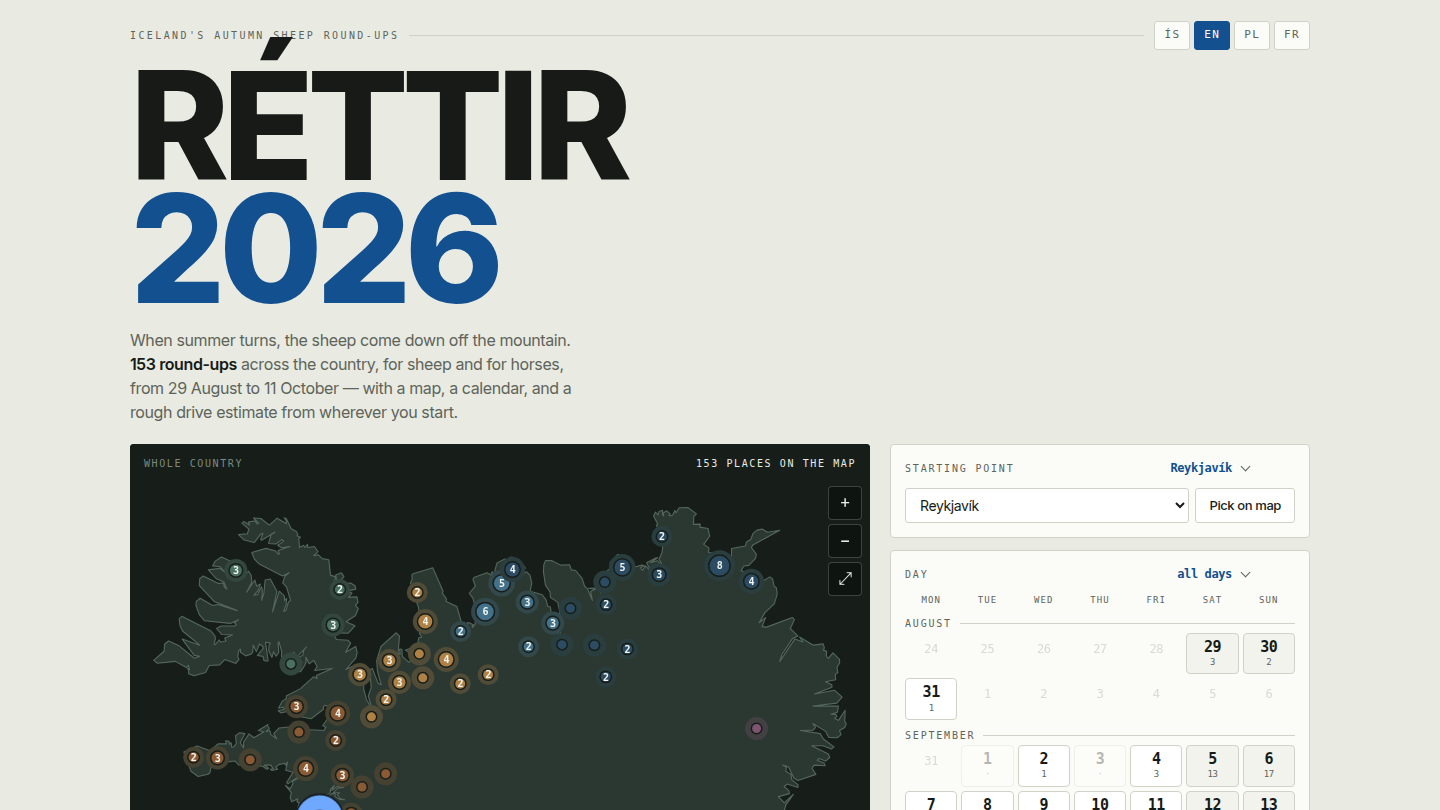
We were staying in Hella and wanted to take the children to a sheep round-up. I found one in Bændablaðið, spent an hour or so searching maps, and picked what I thought must be the place.
We drove out into the countryside and knocked on a farmhouse door. Where were the réttir?
The farmer looked puzzled. They’d been the previous week.
Another attempt near Árnes involved driving around without seeing a single sheep being gathered. We did eventually make it to a round-up in Reykjadal. My youngest son loved watching the sheep, right up until he got close enough to touch one. Then he ran back.
I remember going to réttir as a child, freezing in a wool jumper. I wanted my children to have some of that experience. Preferably with the sheep present.
So when we picked up this year’s Bændablaðið and found the same list of names and dates, I took photos of the pages and gave them to Claude. I wasn’t spending another evening trying to work out where everything was.
The result is Réttir 2026: a map of 153 sheep and horse round-ups from the newspaper’s list, with dates, filters, and four languages. It took eleven days of evenings to get from those photos to the current version. Some locations are still approximate; those are labelled in the tool.
Can we get to this one on Saturday?
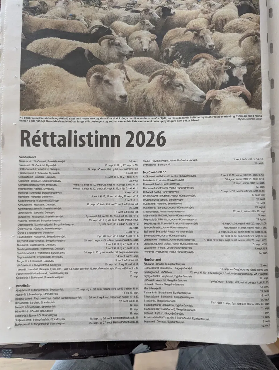
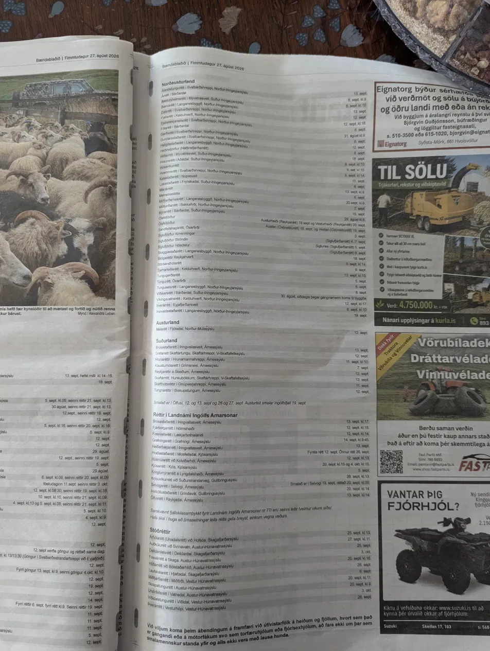
The newspaper had the names, dates, and sometimes the times. If you already knew the places, you could plan your weekend. We needed a map and a way to narrow things down by date and distance.
My first request to Claude was to extract the list from the photos and build that. It asked which language to use, whether to include horse round-ups, and which filters mattered. I answered briefly and left the horses out for now.
Claude warned me that the coordinates would be approximate, based on farms or valleys. At that point, I was using them to judge distance. That warning would matter rather more once the tool had a button for driving directions.
Twenty minutes later I had a single HTML file with 137 réttir on a map of Iceland, a day strip, a distance slider drawn as a ring on the map, and a list. It worked. It also had two bugs I found within a minute of tapping around: picking a date range collapsed into a single day, and there was no obvious way to clear the filters.
I sent three short lines back: the range bug, the clear problem, and “make this look gorgeous, I want to share it with everyone.” The second version fixed both and looked like something I would send to people.
My wife had already been getting questions
People had been asking my wife about réttir. When she saw the map, she pointed out that it could be useful to them too. I put it on my website.
That meant thinking beyond our own trip. Someone starting in Akureyri needed distances from there. Visitors and people who had moved to Iceland needed to be able to read it. The site gained Icelandic, English, Polish, and French, a choice of starting point, and buttons to add a round-up to a calendar or open it in Maps.
One small detail I liked: Claude supplied the dative forms of Icelandic town names, so they read correctly after frá. I hadn’t asked for that.
It was still jerky
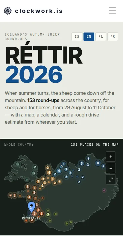
I spent much of one Saturday trying the map on my phone, reporting a problem, and trying the next version. Twelve rounds of it. Zooming stuttered. Scrolling made the map jump. The filters felt slow.
Claude’s browser tests kept coming back with reassuring numbers. I was sitting there dragging the map with my thumb, and it plainly wasn’t smooth.
Eventually it added a frame meter to the page so I could measure it on my actual phone. Most frames were fine. The worst took over a second. Further profiling, using my phone’s screen size and pixel ratio, helped find the expensive drawing work.
One culprit was the pins we’d filtered out. They were still being drawn, just faded. Hiding them completely reduced that cost substantially. A scrolling optimisation we’d added earlier also turned out to make things worse. After the changes, the measured drawing time for a filter reset fell from nearly 600 milliseconds to under 100.
I asked to undo some changes because I preferred how the map had looked before. We measured those individually and kept the ones worth the trade-off. There was a fair amount of going backwards.
The map could send you to an empty field
Late that evening I opened one of the pins in Google Maps with the satellite view on. It was pointing at open moorland. So was the next one I tried.
When I asked Claude to inspect the coordinates, it found that 127 of the original 137 had exactly two decimal places. These were the estimates from the first version. By now, I’d put a driving-directions button next to them.
Having already knocked on one stranger’s door looking for sheep, I wasn’t keen to send other families on a similar outing.
I had Claude search the national place-name register from Landmælingar Íslands and match the names against it. Compared with the register, the old pins were a median of six kilometres out. The worst was 353 kilometres away.
Even the register needed checking. Looking at a few locations, I found points that didn’t identify the pen itself. We added an aerial-image check for each mapped location, looking for the compartments where the sheep are sorted.
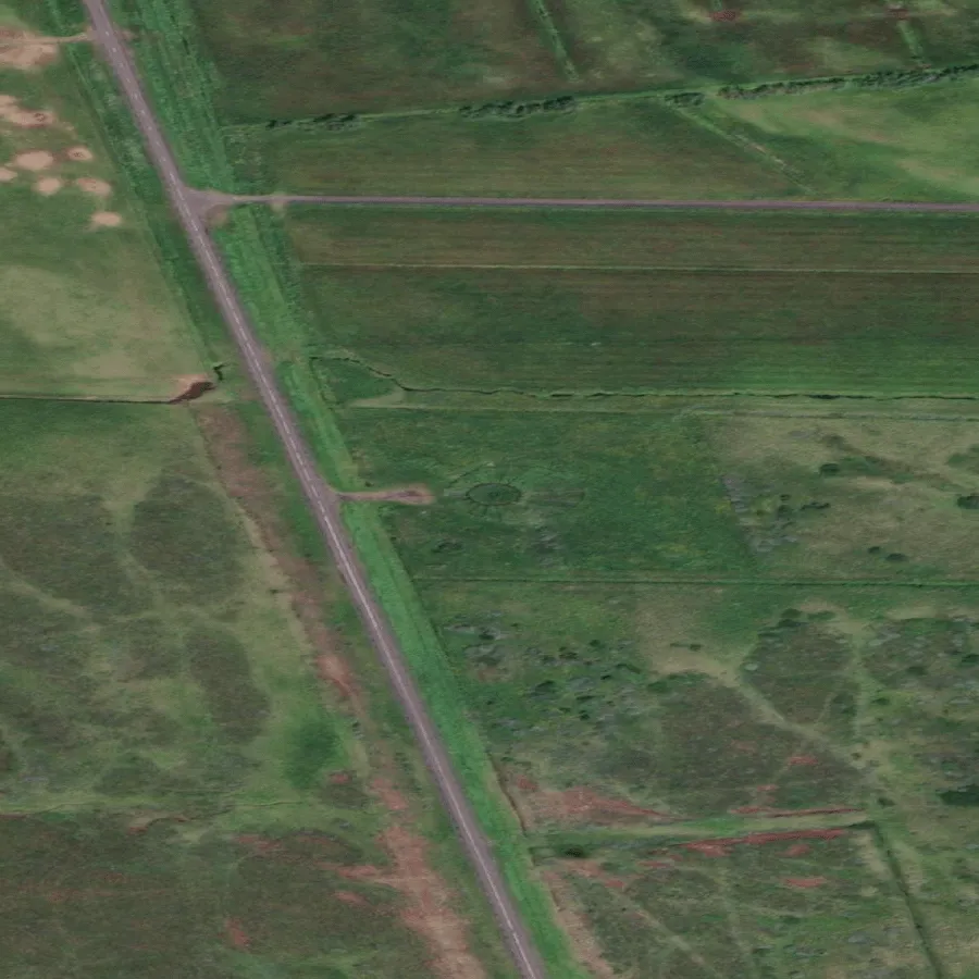
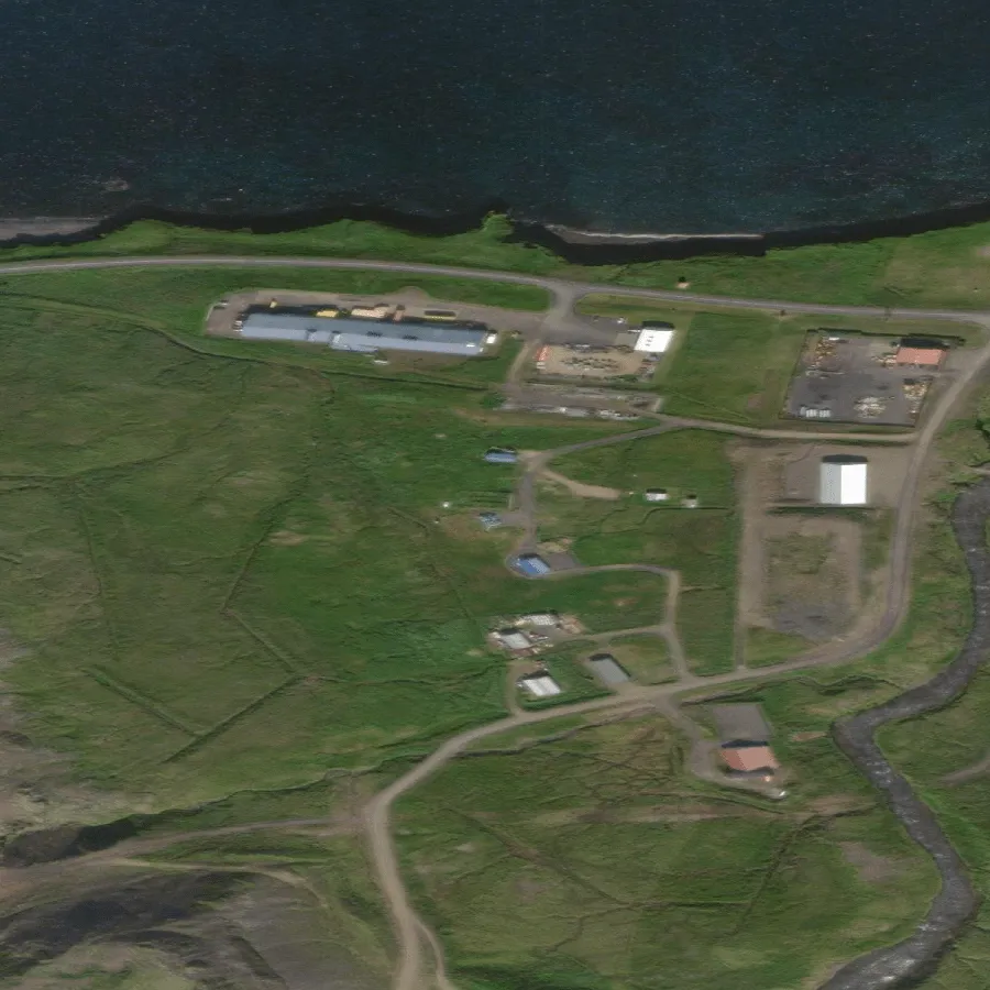
Left: Skógarétt í Reykjahverfi, a wheel of compartments with a holding pen attached. Right: where the old pin for Ólafsvíkurrétt pointed, a warehouse yard on the edge of town.
Some names had more than one point in the register, and we’d picked the wrong one. Others remained uncertain after checking. Those entries now explain whether the point marks a farm or a wider area, and offer a Maps search for the pen’s name instead of directions to an unconfirmed pin.
Then the dates changed
On 6 September, Bændablaðið revised the list. Four dates moved, including one round-up now listed for that same day. Six events were added. Eight names had changed spelling, which initially made them look like new entries too.
Reconciling the update took about an hour, including checking the new locations. We also added the ten horse round-ups; nine used pens already on the map. That brought the list to 153.
The map covers the newspaper’s list, so a blank patch doesn’t necessarily mean there are no réttir there. If you know of a missing event or a misplaced pin, please get in touch. Local knowledge can help with the places we haven’t been able to confirm.
Got a list of your own?
If you’re trying something similar, start with what you want to do with the information. For us, that was choosing a round-up we could reach on a particular day. That gave Claude a much clearer starting point than asking it to improve a newspaper list.
The work went roughly like this:
- Extract the entries. Get the names, dates, and times out of the source, and keep that source handy for checking.
- Build a small working version. Add the controls needed to answer your question. Try them on the phone or computer you’ll actually use.
- Check what the tool tells people. Trace locations and dates back to their sources. Label anything you can’t confirm before someone relies on it.
- Make updates possible. Keep the data separate from the page so a revised list doesn’t mean rebuilding everything.
I’ve written up the process as a Claude Code skill, list-to-living-tool, with more detail on extracting the data, checking locations, and testing performance.
I also told the story on Bítið on Bylgjan; you can listen to the interview here, in Icelandic. There was some discussion of whether the réttir were rétt: right. Fair question, given where the pins started.
For now, the map is ready for planning a trip. I still need to persuade my youngest that he can actually touch a sheep.